Log in
All resources
Create a design
1,095,866 Free Images of Maps Of Rinteln
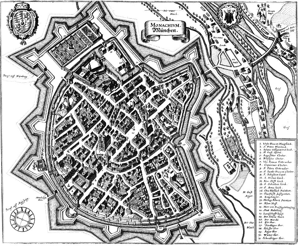
maps by pieter schenk (i)
gerard valck
maps made in the 17th century
atlantis magni tomus secundus (biblioteca comunale di trento)
atlantis magni tomus tertius (biblioteca comunale di trento)
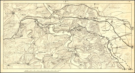
hand-drawn maps and views of world war i battlefields by h.m.
fonds ancely - bibliothèque municipale de toulouse - maps
illustrations of cosmographia (münster)
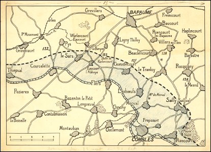
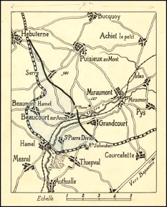
western front maps of world war i
old maps of north america
atlantis magni tomus primus (biblioteca comunale di trento)
17th-century maps of sweden
atlas van der hagen
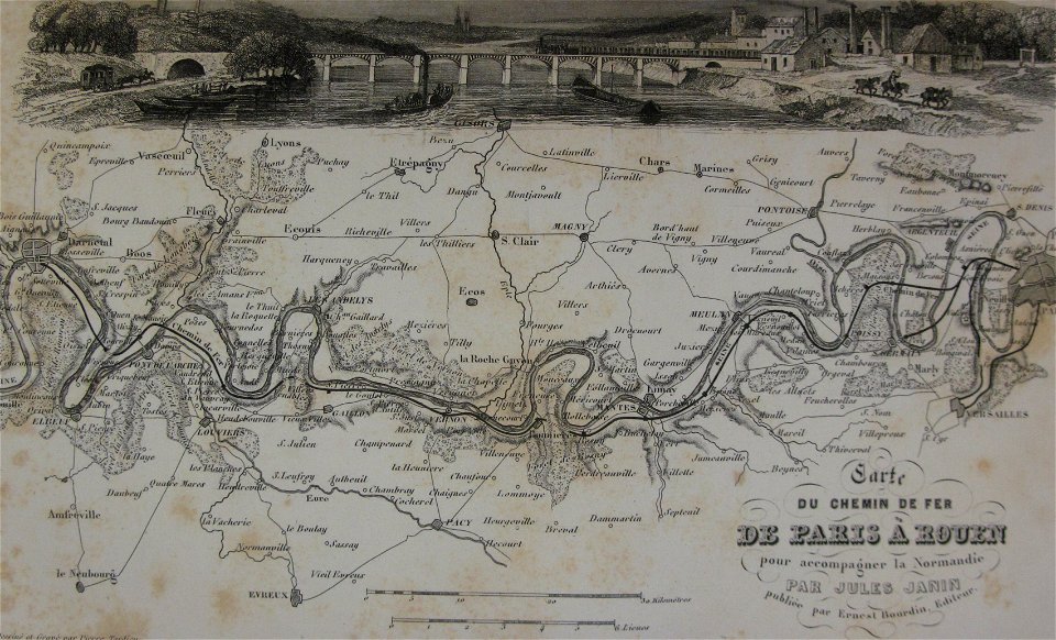
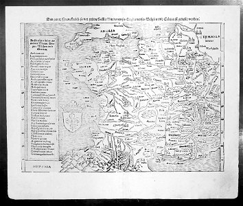
old maps of france
maps of reading abbey
reading
braun & hogenberg
ships on maps
hand-drawn maps and views of world war i battlefields by h.m.
western front maps of world war i
hand-drawn maps and views of world war i battlefields by h.m.
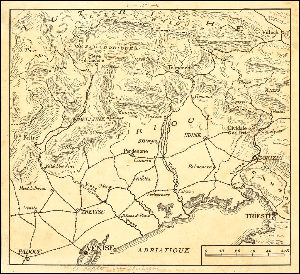
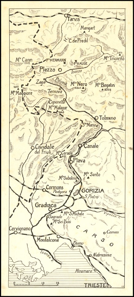
maps of world war i - italian front
hand-drawn maps and views of world war i battlefields by h.m.
western front maps of world war i
hand-drawn maps and views of world war i battlefields by h.m.
western front maps of world war i
hand-drawn maps and views of world war i battlefields by h.m.
western front maps of world war i
hand-drawn maps and views of world war i battlefields by h.m.
maps of world war i - italian front
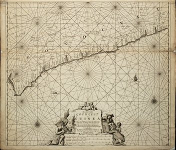
18th-century maps of africa
engravings by jan luyken
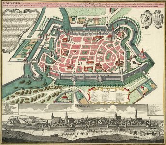
historical images of lüneburg
maps by matthäus seutter
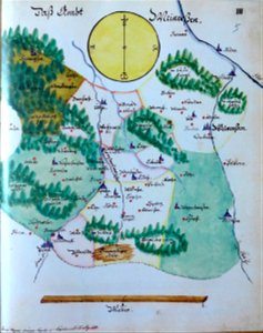
edemissen
meinersen
fonds ancely - bibliothèque municipale de toulouse - maps
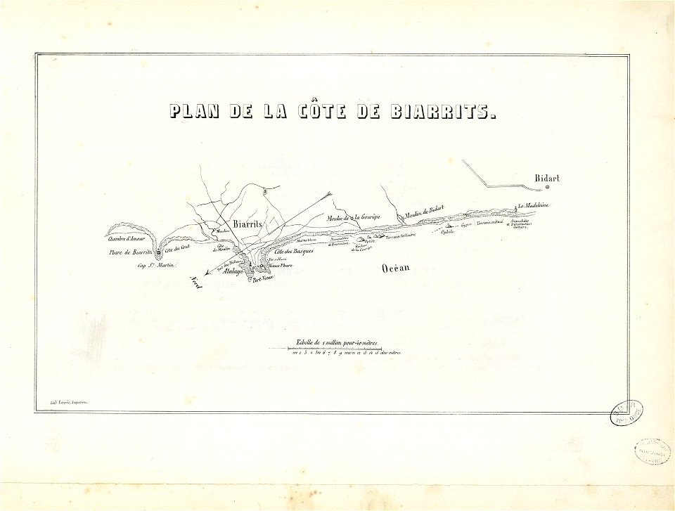
historical images of biarritz
images from the john carter brown library
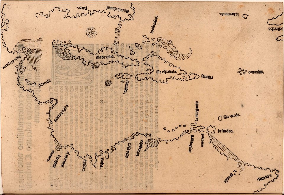
1510s maps of the caribbean
engravings by matthäus merian
engraved maps
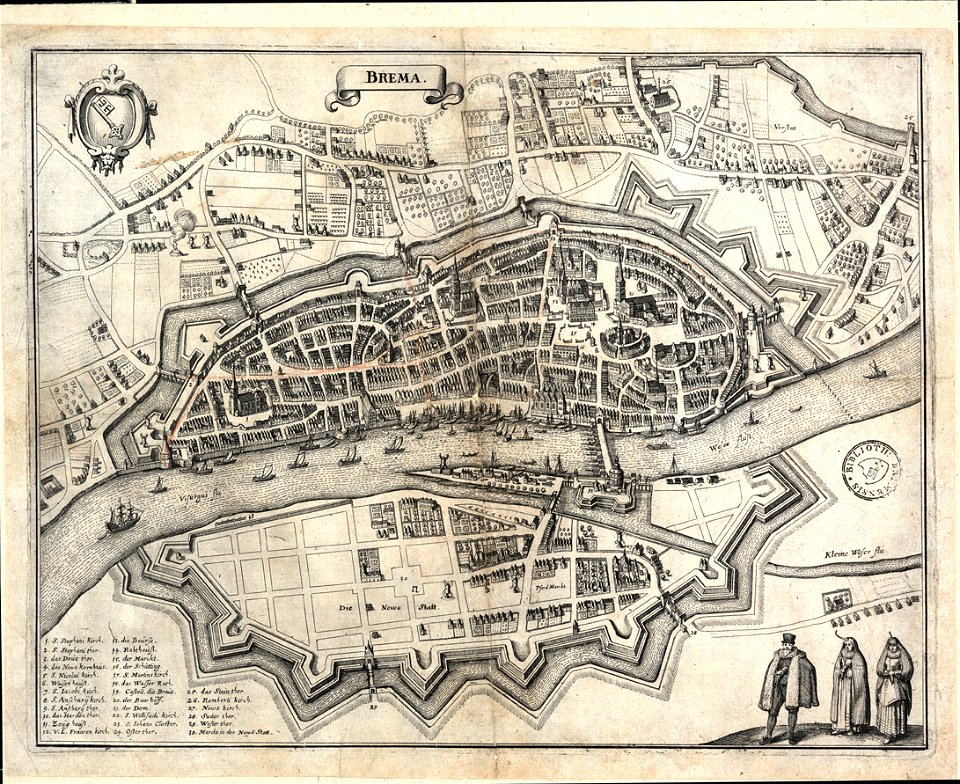
bremen in topographia saxoniae inferioris (merian)
old maps of bremen (state)
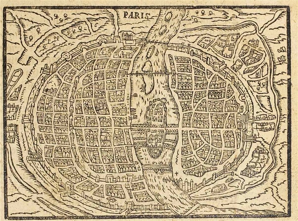
17th-century maps of paris
paris in the 16th century
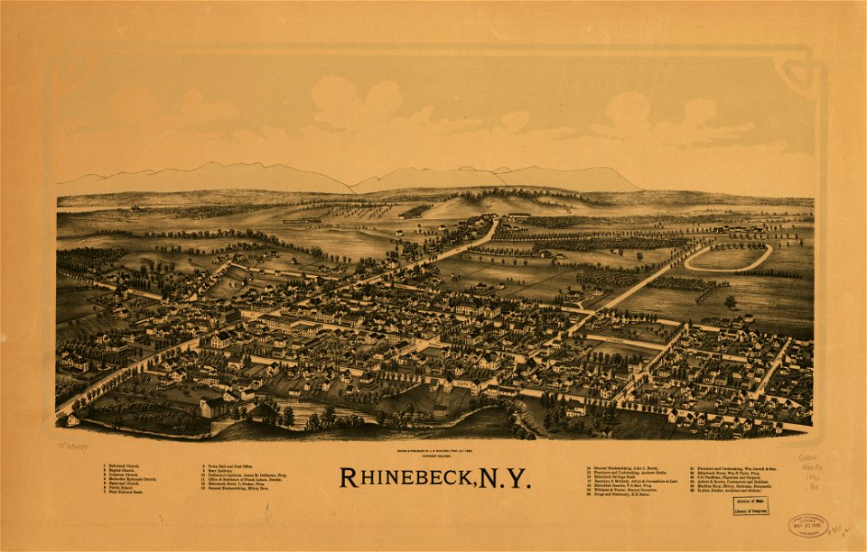
maps in the library of congress
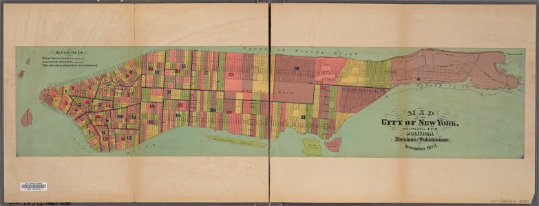
new york
bird's eye view maps of new york city
1867 in new york city
arthur wellesley, duke of wellington (thomas lawrence - apsley house)
romanticism
old maps of north america
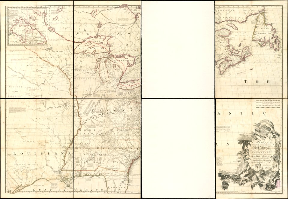
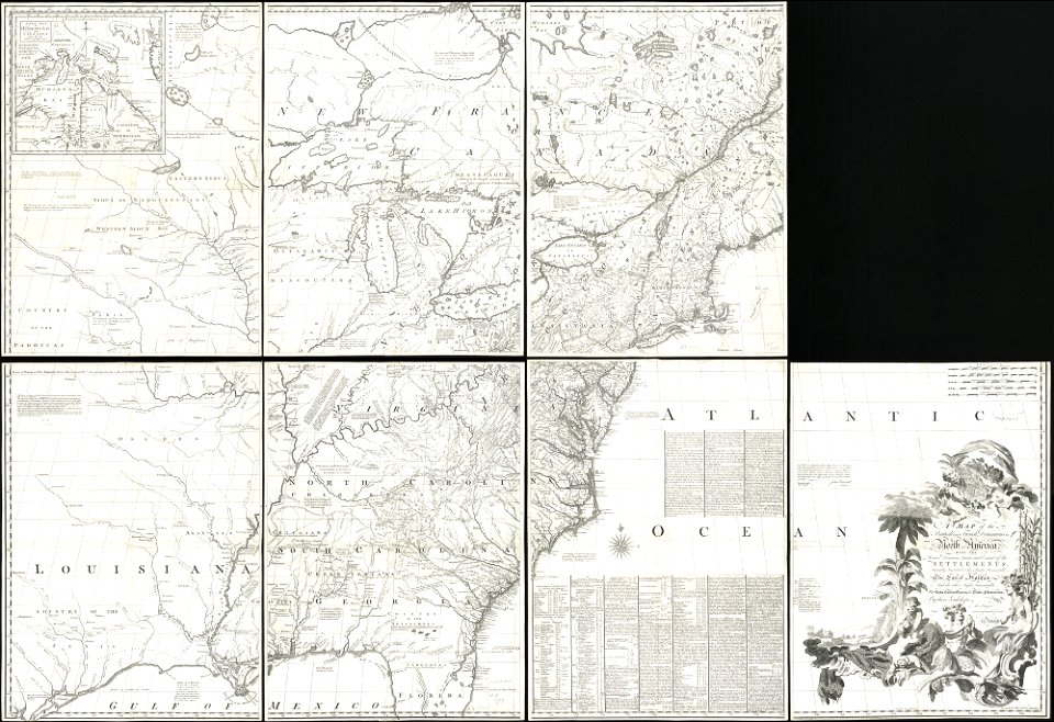
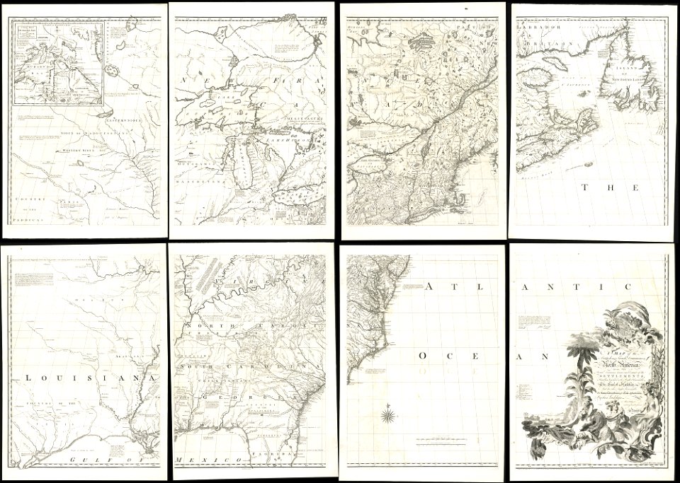
1755 mitchell map
old maps of north america
1755 mitchell map
old maps of north america
1755 mitchell map
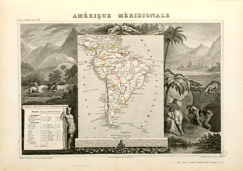
victor levasseur - maps of the world
historical images of arecaceae
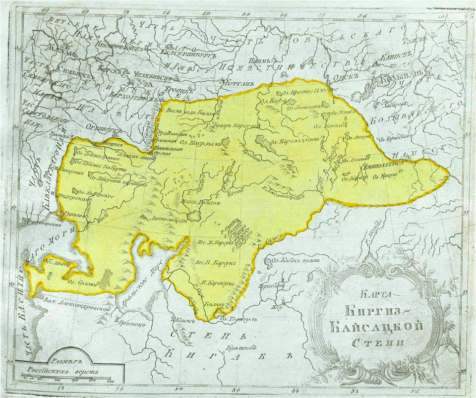
maps of central asia
maps of kazakhstan
manual of the corporation of the city of new york (1870)
new york city
portrait paintings by henrik olrik
paintings in amalienborg palace
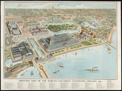
aerial views of the world's columbian exposition
maps of the world's columbian exposition
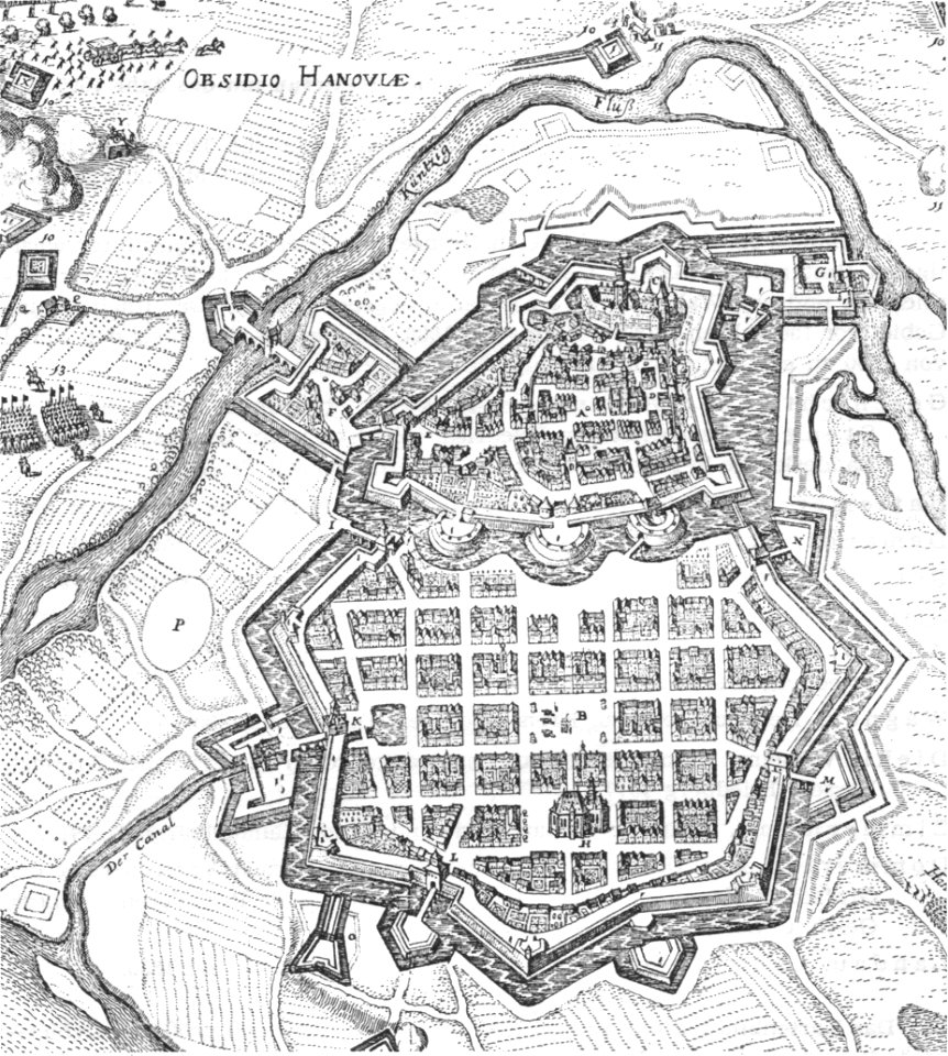
history of hanau
maps of hanau
coats of arms of cities in lot-et-garonne
bernard germain de lacépède
history of tbilisi
tbilisi
hatched coats of arms
old maps of ireland
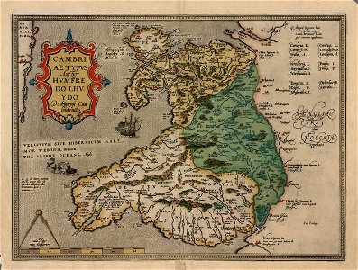
maps in the national library of wales
old maps of whole wales (alone)
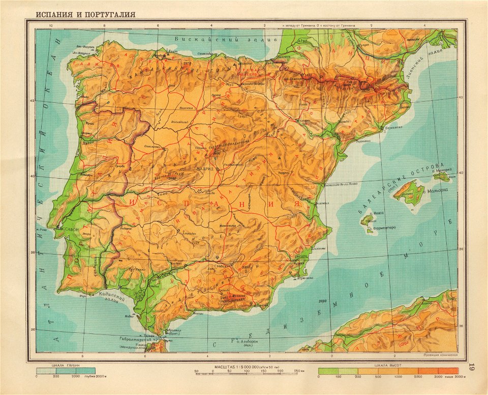
geographical atlas for the 5-6 grades of secondary school (1941)
old maps of the iberian peninsula
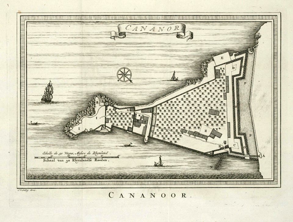
maps of the dutch east india company - india
historical images of st. angelo fort
maps from the mechanical curator collection
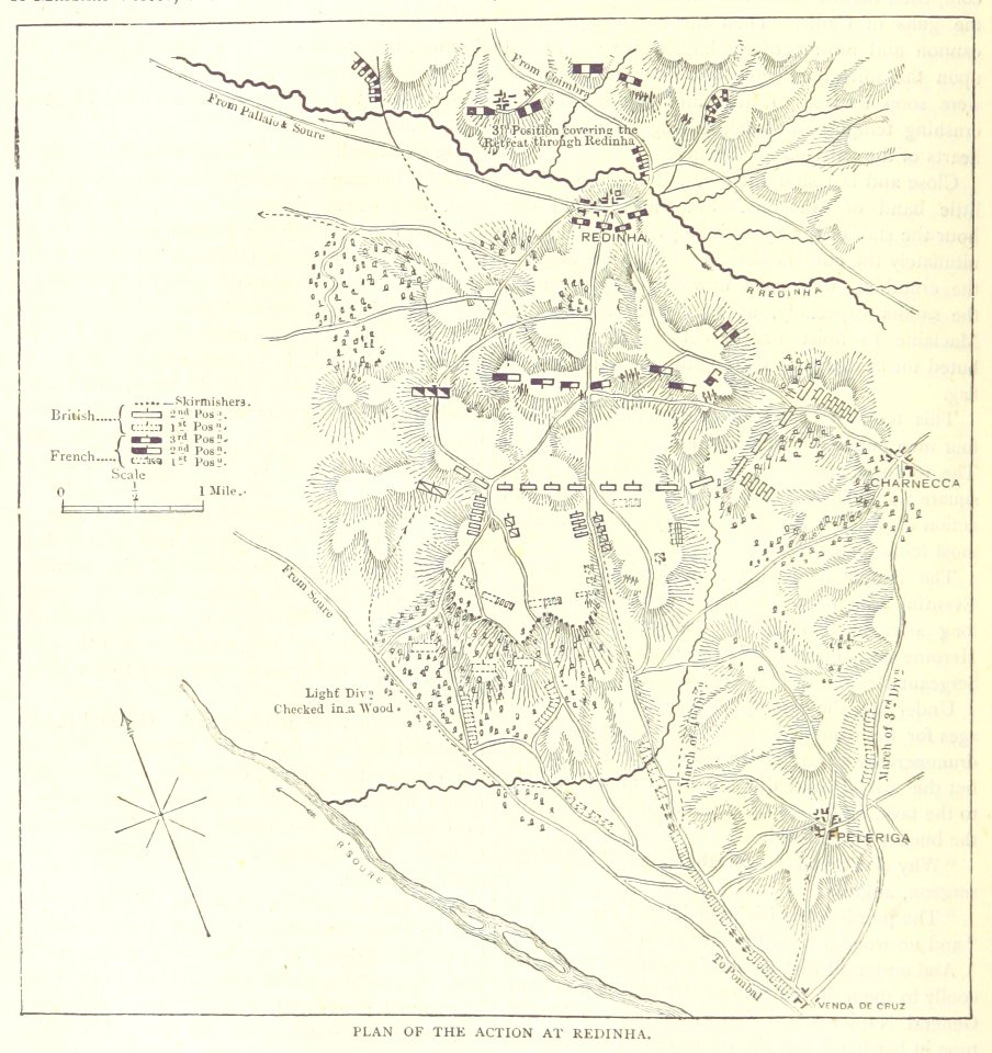
british battles on land and sea
university of toronto wenceslas hollar digital collection
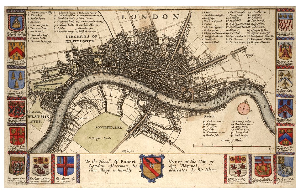
hollar maps and plans of london
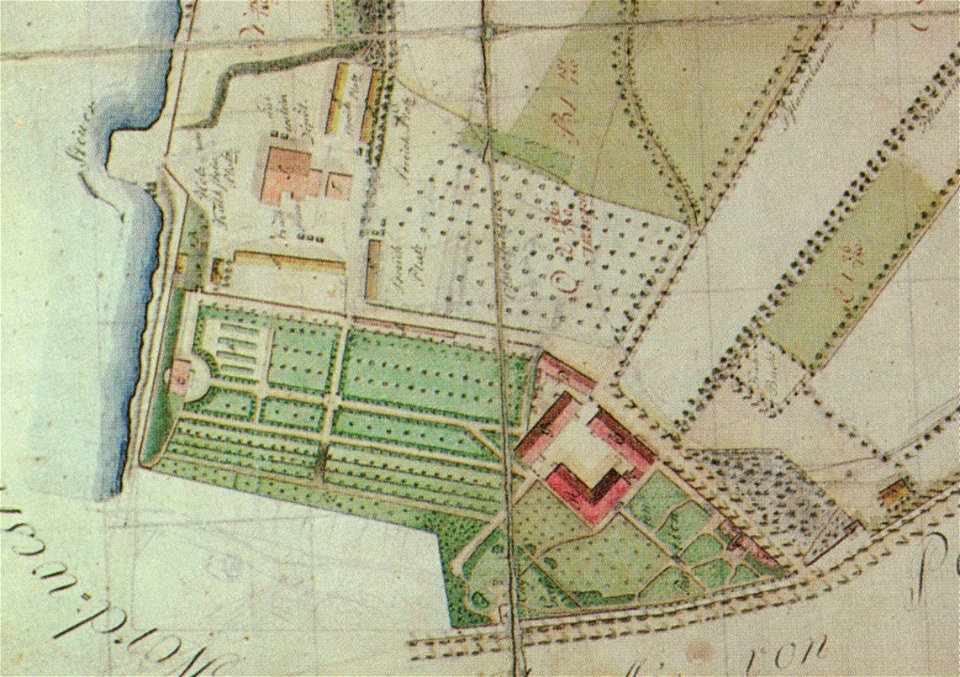
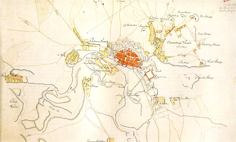
pleasureground (klein-glienicke)
parts of old maps of berlin
alfred johannot
bridge of arts
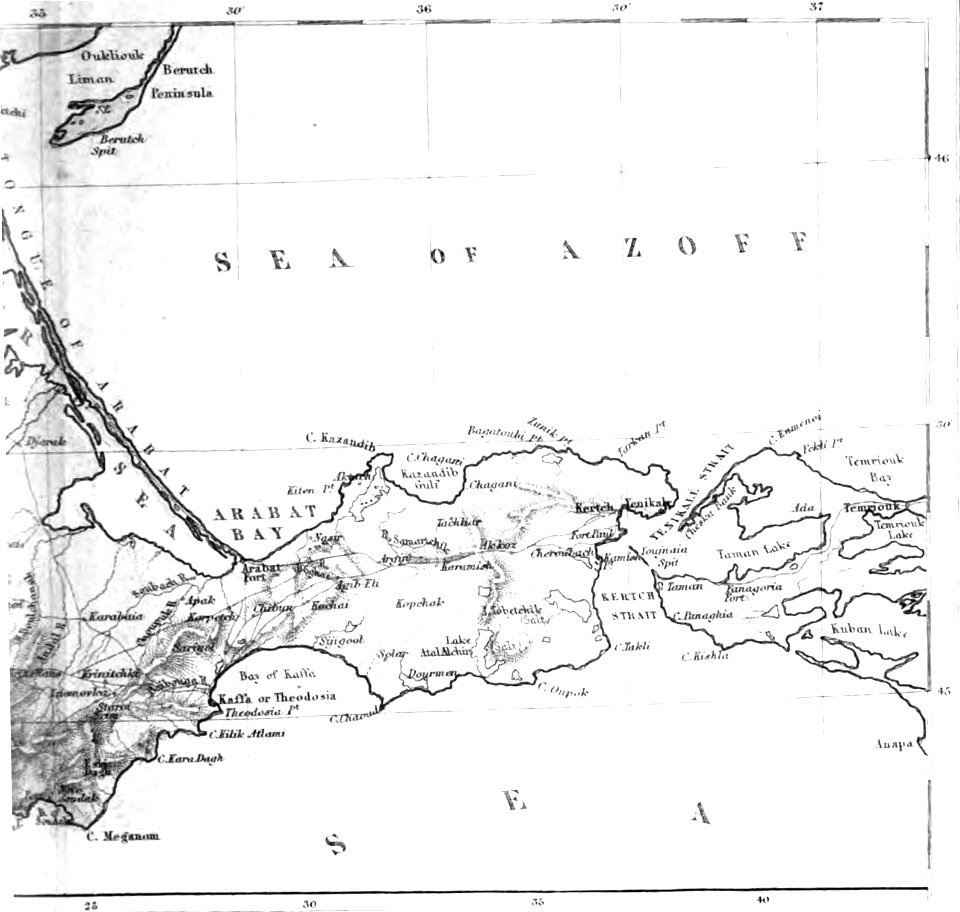
old maps of the sea of azov
1856 maps
fonds ancely - bibliothèque municipale de toulouse - maps
françois arago
old maps of the sea of azov
1856 maps
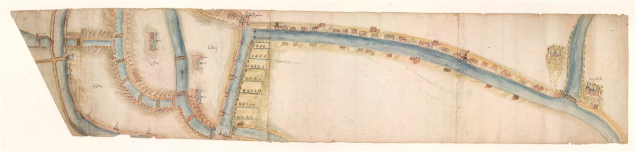
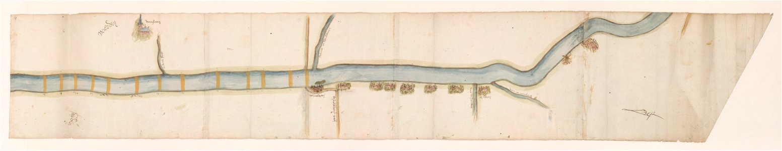
maps of waterways in the netherlands
leiden
maps of waterways in the netherlands
voorschoten
historical documents of the spandau citadel
festung spandau
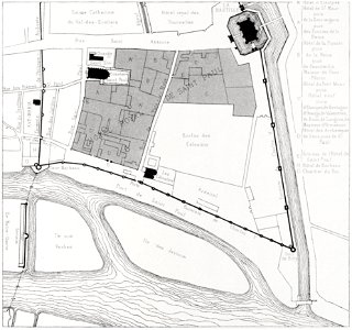
quartier de l'arsenal
bastille
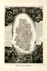
coats of arms of cities in meuse
nicolas oudinot (1767–1847)
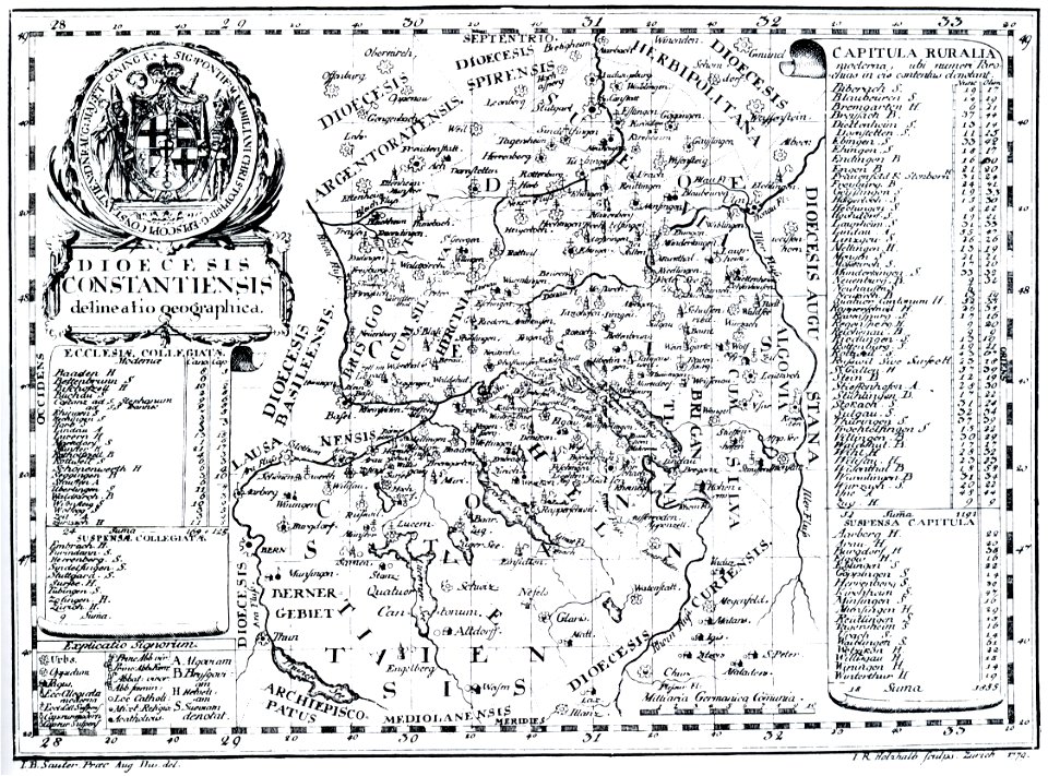
bishopric of constance
1779 in germany
maps by willem and johannes blaeu
coats of arms of zeeland
history of zürich
engraved maps
maps made in the 17th century
gerard valck
maps made in the 17th century
gerard valck
maps made in the 17th century
gerard valck
maps made in the 17th century
gerard valck
cornell university library
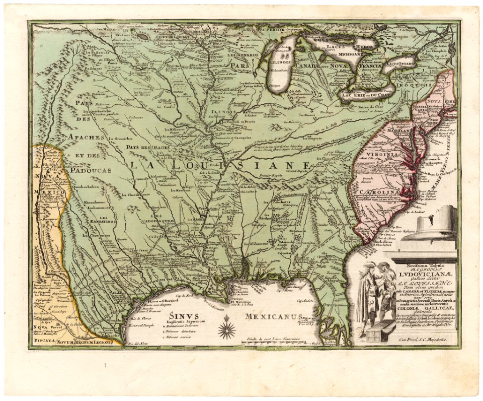
old maps of louisiana
great britain
north sea
maps made in the 17th century
gerard valck
maps made in the 17th century
gerard valck
gerard valck
germany
maps made in the 17th century
gerard valck
maps made in the 17th century
gerard valck
david rumsey historical map collection
j. and p. knapton
maps made in the 17th century
gerard valck
maps made in the 17th century
gerard valck
maps made in the 17th century
gerard valck
maps made in the 17th century
gerard valck
maps made in the 17th century
gerard valck
maps made in the 17th century
gerard valck
maps made in the 17th century
gerard valck
maps made in the 17th century
gerard valck
maps made in the 17th century
gerard valck
maps made in the 17th century
gerard valck
maps made in the 17th century
gerard valck
maps made in the 17th century
gerard valck
maps made in the 17th century
gerard valck
maps made in the 17th century
gerard valck
maps made in the 17th century
gerard valck
maps made in the 17th century
gerard valck
maps made in the 17th century
gerard valck
maps made in the 17th century
gerard valck
maps made in the 17th century
gerard valck
maps made in the 17th century
gerard valck
maps made in the 17th century
gerard valck
maps made in the 17th century
gerard valck
maps from the mechanical curator collection
1869 maps
maps made in the 17th century
gerard valck
viceroyalty of peru
1646
engravings of topographia saxoniae inferioris
maps of bremervörde
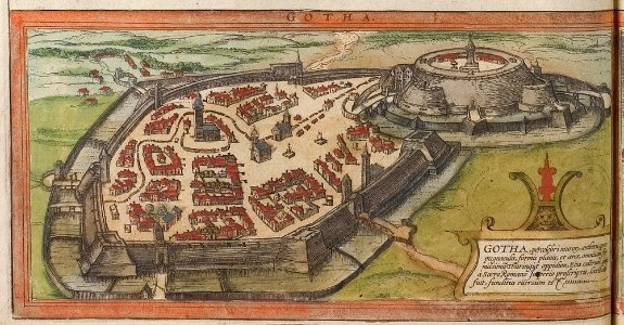
braun & hogenberg
history of gotha
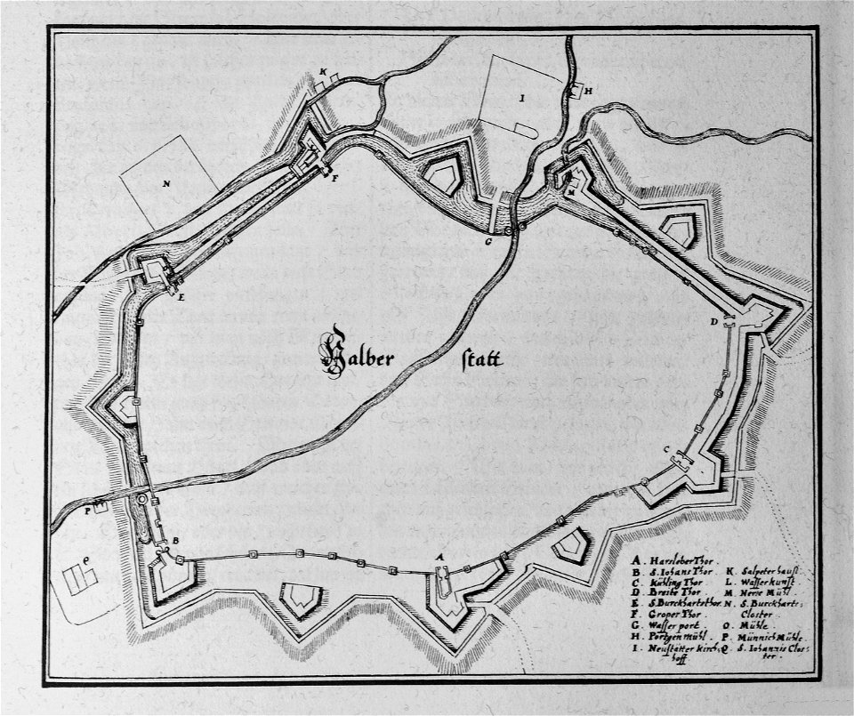
engravings of topographia saxoniae inferioris
maps of halberstadt
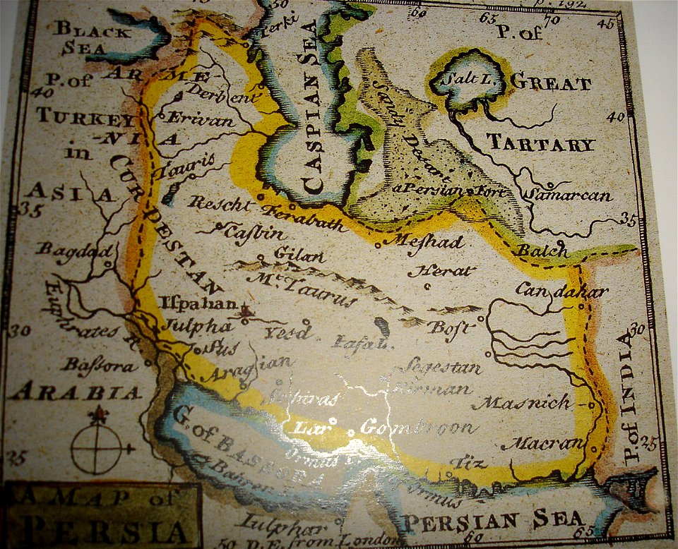
maps of the history of iran
greater iran
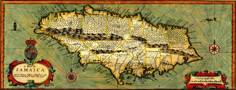
17th-century maps of jamaica
cartography of jamaica
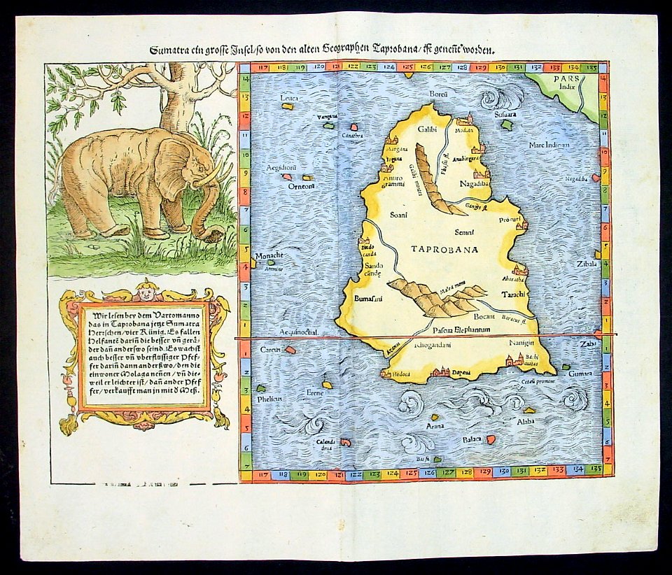
illustrations of cosmographia (münster)
old maps of india
maps of the gulf of corinth
giovanni camocio
great siege of malta
old maps of malta
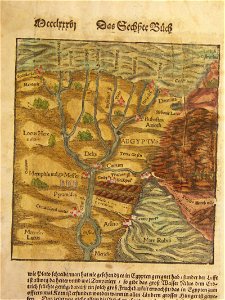
illustrations of cosmographia (münster)
old maps of asia
illustrations of cosmographia (münster)
old maps of france
illustrations of cosmographia (münster)
1580s maps of egypt
illustrations of cosmographia (münster)
1580s maps of egypt
4701 - 4800 of 1,095,866
Next page
/ 10959